Cross-cutting methods
Field methods, sampling and testing
The field and laboratory methods behind every Andrground Engineering report: how the ground is drilled, sampled, tested and monitored across southern and central Alberta, and why each choice is made.
What this is
The work, and what it answers
This is a cross-cutting page. Every other investigation on this site, from raw acreage to a foundation subgrade, a private sewage field, a road, or a slope, rests on the same toolkit: boreholes and test pits, soil samples, field and laboratory tests, and groundwater monitoring. This page sets out how that toolkit works and how the choice is made, so you can read the rest of the site knowing what actually happens on the ground.
There is an honest tension at the centre of geotechnical work. The ground is variable, and a borehole program only ever samples a tiny fraction of it. Every gap that is not measured has to be bridged with a conservative assumption. Conservative is safe, but conservative is not free: it is paid for in extra concrete, extra steel, deeper footings and over-excavation. Good sampling and testing narrows the unknowns so the design fits the ground, instead of paying to cover for what was never looked at.
What does not change is the paperwork behind the numbers. Every hole is logged depth by depth, every sample is tracked, soils are classified to published standards, and the interpretation is analysed and sealed by a Professional Engineer registered with APEGA. The standards named on this page are collected, with links, on the standards page.
Method
Getting the ground into the report: drilling and sampling
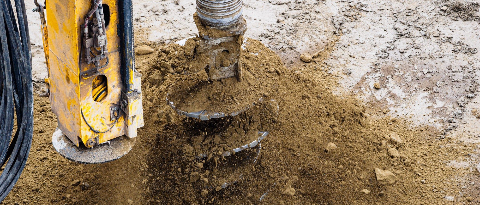
Before any steel goes in the ground the site is cleared: utility locates through Utility Safety Partners (Click Before You Dig) and ground disturbance run to Alberta OHS Code Part 32. Then the hole is advanced. On most southern and central Alberta sites that is a truck- or track-mounted solid-stem or continuous-flight auger, which cuts through the soil and brings up disturbed cuttings that are logged by depth. That gives the stratigraphy: topsoil, weathered clay, clay till (the local glacial till), and the depth to a firm bearing layer or bedrock.
At set intervals, and at every change in soil, a Standard Penetration Test split-spoon sampler is driven to ASTM D1586. The number of blows to advance the sampler 300 mm after seating is the N-value, a field index of how dense a sand or how stiff a clay is, and the first read on strength and bearing. The split spoon also recovers a disturbed sample for classification and moisture in the lab.
Where the design turns on strength or settlement, a disturbed sample is not enough. There a thin-wall (Shelby) tube is pushed to recover an intact, undisturbed core of the soil, which the lab can then shear or consolidate as if it were still in the ground. Tubes can be pushed at the depths that matter, or through the full profile where a private sewage or settlement question demands it. Which method is used is driven by the question, not habit.
- Solid-stem / continuous-flight auger: fast advance, disturbed samples, reads stratigraphy and depth to till or bedrock
- SPT split-spoon (ASTM D1586): N-value plus a disturbed sample at intervals and at every soil change
- Thin-wall (Shelby) tube: intact core for lab strength and consolidation where the design depends on it
- Test pits: an excavator exposes the full soil face for description and is the required method for at least one private sewage soil profile
| Method | Sample it yields | What it answers |
|---|---|---|
| Solid-stem / flight auger | Disturbed cuttings, logged by depth | Soil type, stratigraphy, moisture, depth to till or bedrock |
| SPT split-spoon (ASTM D1586) | Disturbed 50 mm sample plus N-value | Relative density / consistency, an index to strength and bearing |
| Thin-wall (Shelby) tube | Intact, undisturbed core | Lab shear strength, consolidation and settlement, unit weight |
| Excavated test pit | Full exposed soil face, hand samples | Horizons, structure, seepage, restricting layers for site evaluation |
| Standpipe / piezometer install | Water level (not a soil sample) | Groundwater depth and its seasonal range |
Field testing versus laboratory testing, and the cost of not knowing
Field tests happen at the hole and give a real-time index: the SPT N-value, a pocket penetrometer reading on a clay, seepage and colour observations, and on some jobs a cone or dynamic penetration profile. They are quick, cheap, and continuous, but they are indices, correlations rather than direct measurements.
Laboratory tests take the samples back to an accredited lab and measure engineering parameters directly. Soils are classified to ASTM D2487 (the Unified Soil Classification System) and described to ASTM D2488; moisture, Atterberg limits and grain size fix the soil type; consolidation testing to ASTM D2435 quantifies settlement; and compaction curves to ASTM D698 (Standard Proctor) or D1557 (Modified Proctor) set the target for engineered fill. These are the numbers a foundation or pavement design is actually built on.
Here is the trade-off in plain terms. Every parameter that is not measured has to be assumed, and to stay safe it is assumed conservatively. Conservative assumptions are the right call when data is thin, but they are paid for in the structure: a lower allowed bearing pressure means bigger footings, more concrete, more rebar, or over-excavation and engineered fill. Adding the right field and lab tests narrows the uncertainty and often lets the design be right-sized to the ground rather than padded to cover the unknown. Testing has a cost too, so it is scoped to what is at stake: a garage on firm till does not need the program a four-storey building on soft clay does. You are told where more testing would earn its keep and where it would not.
| The question | Field answers it by | Lab confirms it by |
|---|---|---|
| What is this soil? | Visual-manual description (ASTM D2488) | USCS classification (ASTM D2487), grain size |
| How dense or stiff is it? | SPT N-value (ASTM D1586), penetrometer | Shear strength, unconfined compression |
| Will it settle? | Index only, inferred from N | One-dimensional consolidation (ASTM D2435) |
| Will the fill compact? | Field density (construction QA) | Proctor moisture-density (ASTM D698 / D1557) |
| Is it too wet or too dry? | Feel, colour, seepage in the hole | Moisture content on the recovered sample |
Groundwater: standpipes, piezometers, and why the site is revisited
A standpipe is a slotted pipe set in the completed borehole with a sand pack, sealed above, so it reads the depth to the water table. A piezometer, whether a sealed standpipe type or a vibrating-wire sensor, measures pore water pressure at one specific depth, which matters on slopes and in layered ground where the water table is not a single flat surface. Both are installed as the hole is finished, so the data starts building from day one.
One reading is a snapshot, and often a misleading one, because the water level in a freshly drilled hole has not stabilised and because groundwater in Alberta moves with the season. The critical high water level in this region is typically driven by spring snowmelt and breakup, so a reading taken in a dry August can sit well below the level that will actually govern a basement, a slope, or the separation under a septic field. Meaningful monitoring therefore commonly spans weeks to a full seasonal cycle, timed to capture that spring high, rather than a single dip.
Monitoring is warranted whenever a shallow or seasonal water table could reach a basement or below-grade structure, load a slope, or intrude on the vertical separation a private sewage system needs above a restricting layer. For complex private sewage systems (design flows over 9 cubic metres per day), the Alberta Private Sewage Systems Standard of Practice calls for a hydrogeological investigation with at least three monitoring wells, laboratory hydraulic conductivity, and mounding analysis, which is a step beyond a single standpipe.
- Standpipe: reads the water table depth in the borehole
- Piezometer: reads pore pressure at a discrete depth, for slopes and layered ground
- One dip is a snapshot; the seasonal high in Alberta is typically the spring melt
- Monitoring is timed to the spring breakup high, not read once in a dry month
- Complex private sewage systems require three or more monitoring wells and hydrogeological analysis
How deep the investigation goes, and what sets that depth (private sewage)
Investigation depth is itself a field-method decision, and private sewage shows it cleanly. For a site evaluation at least two soil profiles are described, at least one of them an excavated test pit, following the Canadian System of Soil Classification: horizons, colour and redox mottling, texture, structure, consistence, the seasonal-high water table, and any bedrock, impermeable, or restricting layer. The profile goes to roughly 300 mm (about one foot) below the required vertical separation, or down to the restricting condition, whichever comes first.
What sets that required separation is the effluent quality, expressed as Levels 1 to 4. These are treatment classes, not investigation tiers: Level 1 is primary treated effluent straight from a septic tank, while Levels 2 to 4 are progressively higher secondary treatment. The cleaner the effluent, the less soil separation the code requires above a restricting layer, so a higher level buys back separation on a tight site. It does not change how carefully the soil is described, only how deep the separation, and therefore the hole, needs to reach.
One important correction: in Alberta a percolation test cannot be the design basis. Design is based on soil texture and structure mapped to the prescribed loading-rate table in the Standard of Practice. A perc test may be offered only as a supporting verification, never as the design itself, and hand-texturing soil by feel is a useful field aid, not the regulatory method. If a job runs beyond scope, we point clients to the Private Sewage Certified Contractors List.
| Effluent level | Treatment | Typical required vertical separation to a restricting layer |
|---|---|---|
| Level 1 | Primary (septic-tank output) | 1500 mm (5 ft) |
| Level 2 | Secondary | 900 mm (3 ft) |
| Level 3 | Secondary, higher quality | 900 mm; as low as 600 mm (2 ft) only with disinfection |
| Level 4 | Secondary, highest quality | 900 mm (3 ft) |
Winter drilling, spring breakup, and frost
Timing is a field method too. Spring breakup is the worst window for rural Alberta geotechnical work: the thaw saturates the upper soil, farm approaches and field trails turn to mud, road bans limit heavy trucks, and a rig that does get in leaves deep ruts and disturbs the very ground being described. On soft, wet, or low-lying sites, summer access can be no better.
Winter turns that around. A frozen crust bears the drill rig and support trucks, so soft ground, muskeg, low spots, and tight or landscaped lots that are impassable the rest of the year can be reached, with far less rutting and site disturbance. The trade-off is that the frozen upper metre or two is harder to sample and can mask the true moisture and softness of the soil beneath the frost line, so it is logged and interpreted accordingly rather than taken at face value.
Frost also drives design. Footings must bear below the local frost-penetration depth so that seasonal freezing and frost heave in frost-susceptible silty soils do not lift them. That design depth varies across the province and is set by the authority having jurisdiction under the National Building Code, 2023 Alberta Edition; in much of southern and central Alberta it is commonly taken on the order of 1.5 to 2.4 m, but the governing figure for your municipality is used rather than a rule of thumb.
To scope a program, or to ask whether winter access makes sense for your site, reach the practice at 403 700 8672 or andrew@andrground.com.
- Spring breakup: mud, road bans, deep rutting and disturbed samples on rural sites
- Winter: frozen ground bears the rig and opens access to soft or remote sites with minimal disturbance
- Watch point: frozen upper soil is harder to sample and can hide moisture below the frost line
- Frost depth: footings bear below local frost penetration to resist heave, per the NBC Alberta Edition and the local authority
Logged, classified, and sealed
Method is only half of it; the discipline around the method is the other half. Every borehole and test pit is logged in the field, every sample is labelled by hole and depth (for example TH1 at 0.5, 1.0, and 5.0 m) and tracked to the lab, and soils are described to ASTM D2488 and classified to ASTM D2487 so another engineer reading the log sees exactly what Andrew Richardson, P.Eng. saw.
The field and lab data are then analysed against the Canadian Foundation Engineering Manual and the codes in force, and the finished report is sealed by a Professional Engineer registered with APEGA. That seal is not decoration: it means Andrew Richardson, P.Eng. stands behind the log, the testing, and the recommendation. The full reference shelf behind all of this lives on the standards page.
Logged and sealed by Andrew Richardson, P.Eng.
Typical borehole profile, south-central Alberta lot (illustrative)

When you need it
The situations this answers
- Any borehole or test-pit program on raw land, a building site, a road, or a septic field
- When a foundation design needs measured bearing, settlement or fill parameters rather than conservative assumptions
- When a shallow or seasonal water table could affect basements, slopes, or a private sewage system
- Before earthworks where undisturbed samples are needed to confirm strength or consolidation
- When frozen-ground winter access is the only practical way onto a soft, wet, or remote site
- When a reviewer, municipality, or standard calls for testing to a named ASTM method
- When an earlier report leaned on assumptions you now want narrowed with real data
Standards behind this work
See the full standards shelf- ASTM D1586 Standard Penetration Test (SPT)
- ASTM D2487 Soil classification (USCS)
- ASTM D2488 Visual-manual soil description
- ASTM D698 Standard Proctor / D1557 Modified Proctor
- ASTM D2435 Consolidation (settlement)
- Canadian Foundation Engineering Manual (CFEM), 5th Ed.
- National Building Code, 2023 Alberta Edition
- Alberta OHS Code Part 32 Excavating and Tunnelling
- Utility Safety Partners (Click Before You Dig)
- APEGA Practice Standards & Guidelines
Need the ground looked at before you build?
Describe what you are building and where. You get a reply, usually within one business day, setting out what the investigation would cover.
Sealed by Andrew Richardson, P.Eng. Serving southern and central Alberta