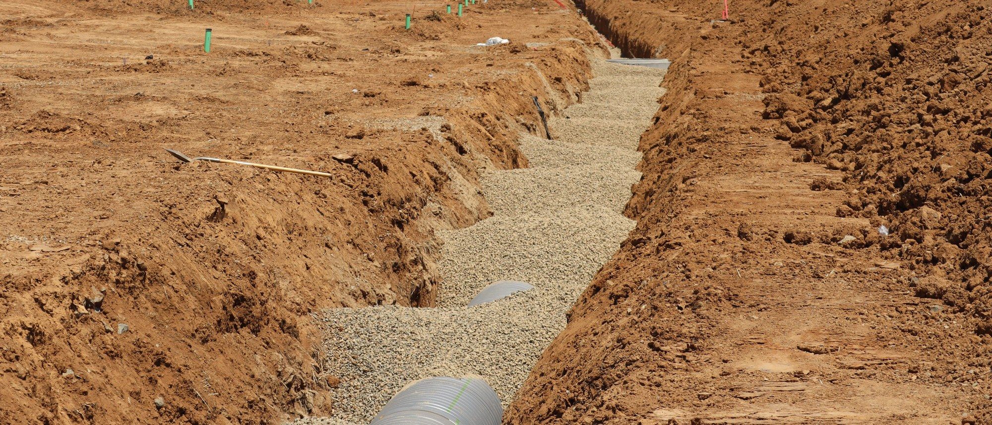
Stormwater: the geotechnical input, southern and central Alberta
Stormwater management report: the geotechnical input
A stormwater management report is a civil engineering deliverable, and the ground it sits on is the geotechnical part: infiltration, seepage, groundwater and slope behaviour are characterised so your pond, basin or storage facility actually performs the way the design assumes.
What this is
The work, and what it answers
A stormwater management report (sometimes called a stormwater management plan, or SWMP) is the document that tells the municipality and the province how a developed site will handle rain and snowmelt without flooding neighbours, eroding channels or overloading downstream infrastructure. It is written and stamped by a civil engineer. What is easy to miss is that most of its critical assumptions are geotechnical: whether the ground will let water soak in, whether a pond will hold water without a liner, where the water table sits, and whether the side slopes and embankments will stand up over years of wetting, drawdown and freeze-thaw.
That is the part Andrew Richardson, P.Eng. provides. He is not the stormwater designer; his job is to put real, measured ground behaviour under the design so it is defensible. When a report says a facility will infiltrate at a given rate, or that a pond bottom is tight enough to retain a permanent pool, or that a 4:1 side slope is stable, those statements need a subsurface investigation behind them, not an assumption copied from a textbook.
We work across southern and central Alberta on subdivisions, acreages, and commercial and industrial sites. Every borehole and test pit is logged, every sample and field test is analysed, and the geotechnical report that feeds your stormwater design is sealed by a Professional Engineer registered with APEGA. Where a specific number is set by a municipal servicing standard or provincial guidance rather than by the geotechnical report, the report says so and points to the governing document.
Method
What the geotechnical part of a stormwater report actually covers
A stormwater management report answers a civil question: for a given design storm, how much runoff does the developed site generate, how is it stored, and at what rate is it released so downstream systems are not overloaded. Municipalities commonly cap the release at the site's pre-development flow, with the exact target set by the local servicing standard rather than by the geotechnical report.
The geotechnical job is the layer underneath those calculations. A pond that is supposed to store water only works if the ground holds it. An infiltration facility only works if the ground takes water at the assumed rate. A side slope only works if the soil, the groundwater and the loading it will actually see keep it stable. The facility footprint is investigated specifically, because the soils under a proposed pond are frequently different from the soils under the building pads a few tens of metres away.
In practical terms that means characterising the soil stratigraphy, the permeability of each layer, the depth and seasonal range of groundwater, and the shear-strength and compressibility of the materials that will form or support the facility. Those inputs are what let the stormwater designer choose between a lined wet pond, a dry detention pond, or infiltration, and defend that choice to the reviewer.
- Where the water goes: infiltration capacity of the native soils, and whether it is fast enough to rely on.
- Whether the pond holds: permeability of the pond bottom and the need (or not) for a clay or synthetic liner.
- Whether it stands up: side-slope and embankment stability, including the rapid-drawdown case when a pond empties quickly.
- What the water table does: seasonal-high groundwater, buoyancy, and seepage into or out of the facility.
- What settles: consolidation of soft or fill soils under berms, inlets and outlet structures (ASTM D2435).
How it fits the approval chain
A stormwater report is rarely a standalone request. It is usually triggered by a subdivision application, a development permit, or a servicing agreement, and it is reviewed against the municipality's own servicing and drainage standards. Across southern and central Alberta those standards vary: the City of Calgary, Rocky View County, Foothills County and the smaller towns and villages each publish their own drainage and servicing requirements, and the reviewing municipality is the final word on release rates, freeboard, side-slope limits and setbacks.
Larger or more sensitive facilities also engage the province. Stormwater management facilities in Alberta are commonly approved under the Water Act and the Environmental Protection and Enhancement Act, administered by Alberta Environment and Protected Areas, and that provincial guidance expects the design to be supported by appropriate site information including groundwater. The geotechnical and groundwater portion that both the municipal reviewer and the provincial approval expect to see is what this report supplies.
Because the requirements are set by others, the report attributes rather than invents. Where it needs a specific side-slope limit, freeboard, or release rate, it points to the governing municipal servicing standard or provincial guideline instead of stating a house number as if it were law. What Andrew Richardson, P.Eng. owns is the measured ground behaviour that those requirements are applied to.
Facility type drives the geotechnical question
Different stormwater facilities ask the ground to do opposite things. A wet pond has to hold water; an infiltration basin has to lose it. That single distinction changes what is tested for and what a good result looks like. The table below is the plain-English version of how the investigation is scoped to the facility your civil engineer is proposing.
| Facility type | What the ground has to do | What is investigated |
|---|---|---|
| Dry (detention) pond | Store runoff briefly, then drain and stay dry between storms | Depth to groundwater (so it actually stays dry), subgrade support and settlement under the outlet, and side-slope stability |
| Wet (retention) pond | Hold a permanent pool without leaking away | Permeability of the pond bottom, whether a compacted clay or geosynthetic liner is needed, and drawdown stability of the slopes |
| Infiltration facility (basin, soakaway, bioretention) | Let stormwater soak into the ground at a reliable rate | Measured infiltration / hydraulic conductivity, depth to groundwater and to any restricting layer, and whether tight till makes infiltration unviable |
| Constructed wetland | Maintain a shallow saturated zone and pool | Low-permeability bottom, groundwater interaction, and stability of shallow slopes and berms |
| Underground / vault storage | Store water in a buried structure | Bearing and settlement for the structure, groundwater buoyancy (uplift), and excavation stability during construction |
Infiltration, seepage and liners
The first question on most sites is honest and unglamorous: will water go into this ground, or will it sit on top? Much of southern and central Alberta is underlain by glacial clay till, which is often too tight to infiltrate meaningfully. That is not a failure; it just means an infiltration-based design may not be defensible on that site, and a lined or detention approach is the realistic answer. We would rather tell you that at the investigation stage than have a reviewer reject an infiltration rate that the ground cannot deliver.
Where infiltration is plausible, it is characterised with an appropriate field or laboratory method, and that method is stated plainly, so the designer and the reviewer can weigh the number for what it is. For retention facilities the opposite property is assessed: whether the pond bottom is tight enough to hold a pool, or whether it needs a compacted clay liner (with compaction controlled to Standard or Modified Proctor, ASTM D698 / D1557, and separate hydraulic-conductivity testing to confirm the low permeability the liner depends on) or a geosynthetic liner. Seepage matters in both directions: water leaking out of a wet pond, and groundwater or a permeable sand seam feeding into a pond that was meant to be dry.
Where the answer depends on the season, the recommendation is groundwater monitoring rather than a single snapshot. A dry-season borehole can badly understate the water table that a facility will actually see in spring, and getting that wrong is one of the more expensive mistakes in stormwater design.
Side slopes, embankments and settlement
Pond side slopes and containment berms are small earth structures, and they are subject to the same failure modes as larger ones: shallow sloughing when saturated, deeper rotational instability, and the rapid-drawdown case where a pond that has been full for weeks empties in hours and the still-saturated slope loses support. Side-slope and embankment stability is assessed using the site's measured soil strengths, following Canadian geotechnical practice as set out in the Canadian Foundation Engineering Manual, and the recommended slope angles satisfy both stability and the municipality's servicing limits.
Settlement is the quieter risk. Inlet and outlet structures, control weirs and access ramps sit on subgrade that may be soft, may be fill, or may consolidate under the weight of a berm. Consolidation testing (ASTM D2435) is used where compressible soils are present so the designer can allow for movement rather than discover it. Excavation for the facility itself is governed by the Alberta OHS Code Part 32, and buried utilities are located through Utility Safety Partners (Click Before You Dig) before any ground disturbance.
How it ties back into the civil stormwater design
The deliverable is written to be used, not filed. It gives your civil engineer the specific parameters the stormwater model and grading design need: infiltration rate (or a clear statement that infiltration is not viable), whether a liner is required and of what type, stable side-slope angles, the design groundwater level, buoyancy considerations for any buried structure, and settlement guidance for the ancillary structures. Limitations are stated in plain language so nothing is over-read.
We coordinate directly with the stormwater designer and, where useful, with the reviewing municipality, so that the numbers in the geotechnical report and the numbers in the stormwater report actually agree. This page is one step in a sequence: a subdivision or commercial investigation often identifies the need for a stormwater facility in the first place, and a site with coulees, banks or steep drainage may also need a separate slope-stability and setback assessment. Every geotechnical report in that chain is logged, analysed and sealed by a P.Eng. registered with APEGA.
Logged and sealed by Andrew Richardson, P.Eng.
Typical profile, stormwater pond site (illustrative)
When you need it
The situations this answers
- You are subdividing raw land or an acreage and a new stormwater facility (dry pond, wet pond, constructed wetland or infiltration basin) is proposed as part of servicing.
- A commercial or industrial development requires a detention or retention pond, or underground storage, as a condition of the development permit or servicing agreement.
- The municipality requires a stormwater management report before it will approve the subdivision, servicing plan or building permit, and that report needs subsurface and groundwater data to stand up.
- A provincial approval for the stormwater facility (typically under the Water Act and the Environmental Protection and Enhancement Act, administered by Alberta Environment and Protected Areas) needs supporting geotechnical and groundwater information.
- Low-impact development features (bioretention cells, soakaways, infiltration trenches or basins) are proposed and the design has to demonstrate that the ground can actually infiltrate at the assumed rate.
- An existing pond is misbehaving: a wet pond that is losing its pool, a dry pond that will not stay dry, seepage breaking out at the toe, or slumping on the side slopes.
- A redevelopment increases impervious area beyond what the site currently discharges, so storage and release have to be re-engineered on ground whose behaviour was never characterised.
Standards behind this work
See the full standards shelf- Geotechnical Investigation Guidelines for Alberta Infrastructure Projects (v2.0)
- Canadian Foundation Engineering Manual (CFEM), 5th Ed.
- ASTM D2487 Soil classification (USCS)
- ASTM D2488 Visual-manual soil description
- ASTM D2435 Consolidation (settlement)
- ASTM D698 Standard Proctor / D1557 Modified Proctor
- Alberta OHS Code Part 32 Excavating and Tunnelling
- Utility Safety Partners (Click Before You Dig)
- National Building Code, 2023 Alberta Edition
- APEGA Practice Standards & Guidelines
Need the ground looked at before you build?
Describe what you are building and where. You get a reply, usually within one business day, setting out what the investigation would cover.
Sealed by Andrew Richardson, P.Eng. Serving southern and central Alberta